Jerusalem – and the Old city of Jerusalem in particular – is an important destination for people from all over the world whether they practice Christianity, Judaism, Islam or any other religion.
This page features different maps depicting different periods in the history of Jerusalem (some of them in Jerusalem Map pdf):
Tourist Map of Jerusalem Today
Click on the Map to watch the Map in full details

A tourist map of the City of Jerusalem – an up-to-date street map of the city of Jerusalem featuring tourist sites, attractions and valuable tourist information – Click here for more info
Jerusalem Map Time of Jesus
Click on the Map to watch the Map in full details

- Map of Jerusalem at the time of Jesus – a Map of Jerusalem during the time of Herod the Great. This is also when Jesus arrived to Jerusalem and eventually, where he was condemned to death and walked the Via Dolorosa (Latin for ‘Way of Grief’). He was crucified where the Church of the Holy Sepulchre now stands, and where – according to Christian belief – he was resurrected and returned to bodily life – Click here to view the map
[recommend-gallery]
- The City of David is the oldest settled neighborhood in Jerusalem as we know it. Archeological evidence takes it back to the Bronze Age. King David captured the city from the Jebusites circa 1000 BCE, established Jerusalem as his capital and built his temple there. The city is bordered by the Hinnom Valley to the south and the Kidron Valley on the east – Click here to view the map
- Jerusalem during the period of King Solomon – King Solomon, the son of King David, enlarged and beautified the city of David and built the First Temple on the site of the Temple Mount. According to the Bible, King Solomon was chosen to build the First Temple because – unlike his father – his hands were not stained with the blood of his enemies, thus he was not precluded from building a temple to God – Click here to view the map
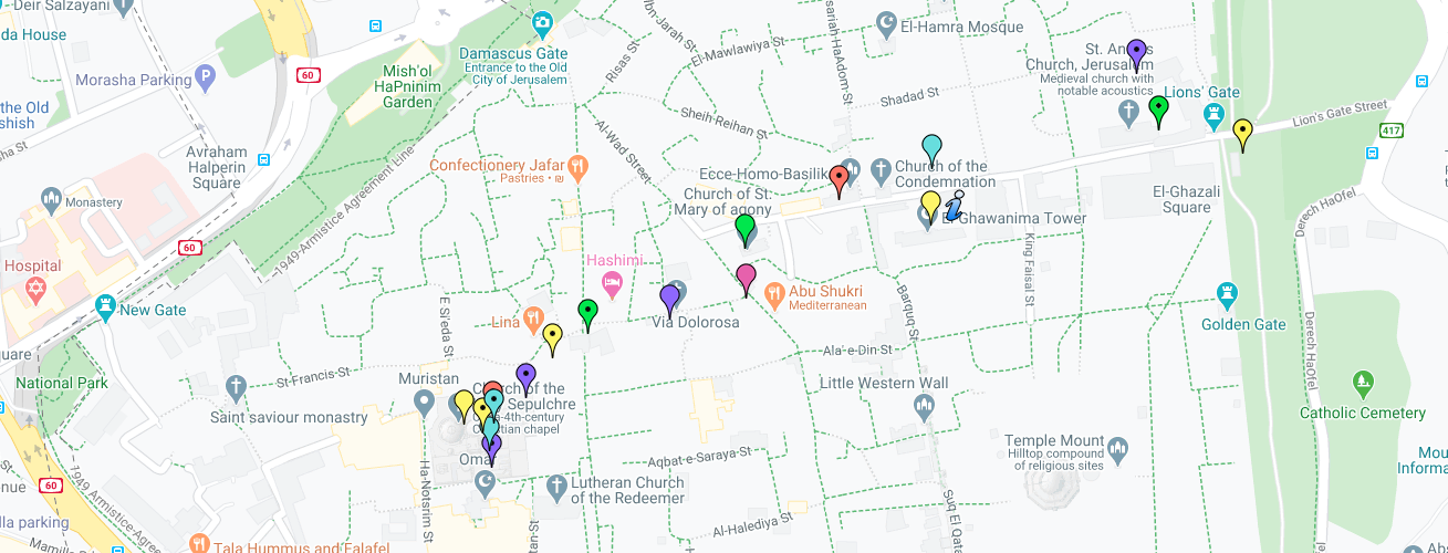
- Via Dolorosa Map – a street within the Old City of Jerusalem, held to be the path that Jesus walked, carrying his cross, on the way to his crucifixion. It is today marked by nine Stations of the Cross; there have been fourteen stations since the late 15th century, with the remaining five stations being inside the Church of the Holy Sepulchre. The route is a place of Christian pilgrimage. The Via Dolorosa is considered to be one of the most ancient spiritual walking routes for Christians the world over – Click here to view the map
Mount of Olives Map – Video Map – this is a Map created using Google Maps. The Map includes all the Holy Sites for Christians at the Mount of Olives with a dedicated Video for each site that tells its story.
View Mount of Olives Map – Video Map in a larger map
Via Dolorosa Map – Video Map – this is a Map created using Google Maps. The Map includes all the 14 stations along the Via Dolorosa with a dedicated video for each station that tells its story.
View Via Dolorosa Map – Video Map in a larger map
Now, Let’s All Live the Jerusalem Experience !!!